Part of ancient Alexandria’s urban evidence survives beneath the Mediterranean. In the Eastern Harbour, archaeological surveys have mapped an earlier coastline, piers, breakwaters and probable structures associated with the royal quarter. Near Qaitbay, many architectural pieces and statues occupy a field that includes material associated with the Pharos lighthouse area and objects moved in later history. In Abu Qir Bay, submerged settlements share the seascape with wrecks from a much later naval conflict.
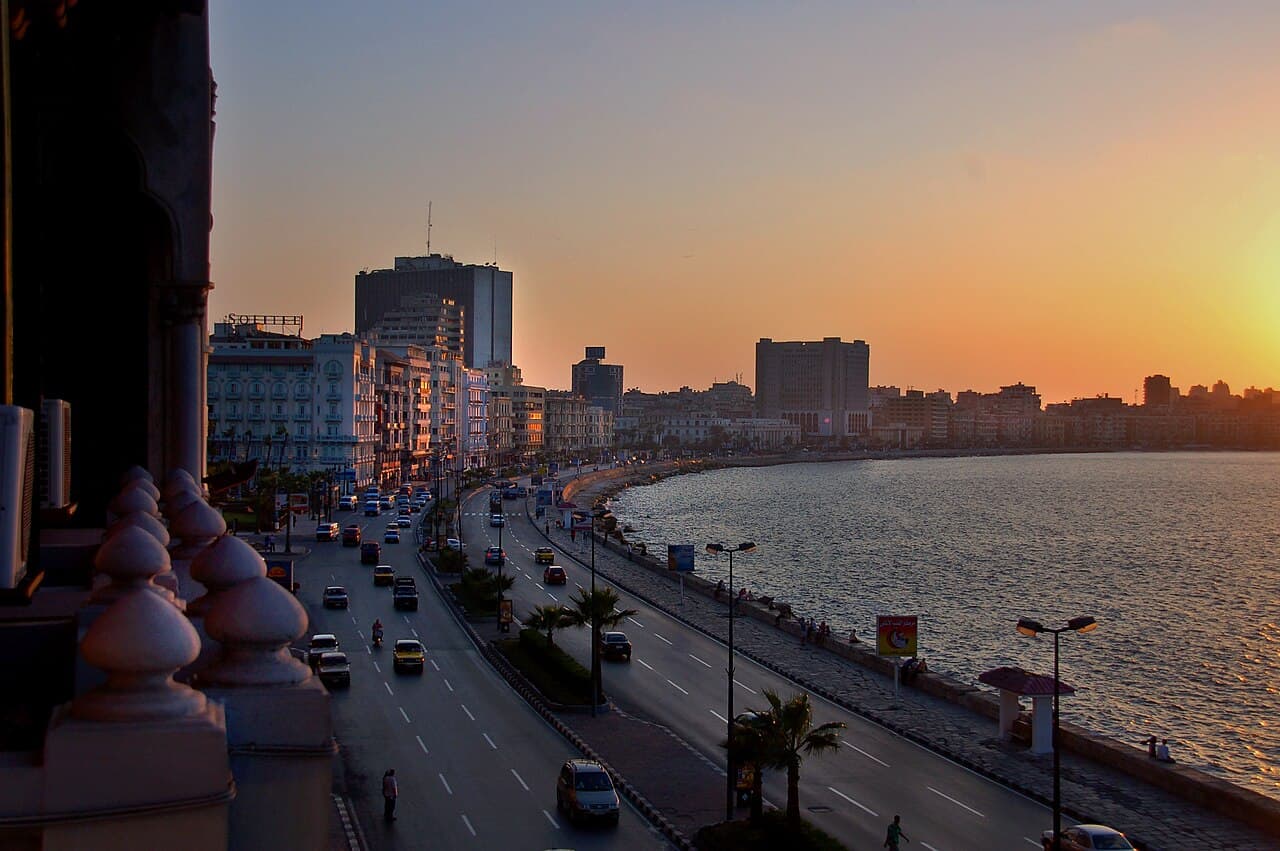
These are not one lost city, and they are not a public underwater theme park. The evidence belongs to distinct sites, dates and research histories. This feature explains how underwater archaeology changes the map of Alexandria while resisting the temptation to identify every block as lighthouse debris. The accompanying waterfront photograph is modern city context only; it does not show a submerged monument or confirm public diving access.
At a glance
Start here
- The Eastern Harbour preserves the drowned outline of ports and parts of the ancient royal quarter.
- Qaitbay’s underwater field contains mixed material, so not every piece should be labelled as Pharos debris.
- Abu Qir combines ancient settlement evidence with later shipwreck history and must remain geographically distinct.
- Survey maps, context and controlled recovery matter more than a dramatic isolated object.
01
First, move the ancient coastline
The Ministry’s Eastern Harbour page describes a submerged landscape extending between Ras el-Silsila and Qaitbay, with ancient remains below the modern waterline. Survey has identified the contour of an earlier coast, long piers and a major breakwater. That evidence requires readers to redraw Alexandria: parts of the royal city now sit offshore rather than neatly beneath modern streets.
A changed coastline also explains why a waterfront view can be historically important without showing visible ruins. Archaeologists combine position, seabed survey, architecture and recovered material to reconstruct the harbour. The sea surface conceals context, so an attractive photograph cannot substitute for a mapped site record.
Sources: Egyptian Ministry of Tourism and Antiquities; Egyptian Ministry of Tourism and Antiquities02
Map a royal harbour, not a single palace
The Eastern Harbour evidence includes several port areas, piers, a breakwater and locations associated with Antirhodos and the Timonium. The Ministry reports probable remains of a palace, theatre and temple in the former royal quarter. “Probable” matters: underwater architectural fields are interpreted through spatial relationships, not through one perfectly labelled façade.
The harbour was infrastructure as well as royal display. Ships required protected water, approaches and working edges; palaces and administration depended on access to the Mediterranean. Seeing these functions together makes the submerged site an urban district. It is more informative than imagining one palace sinking intact in a single catastrophe.
Sources: Egyptian Ministry of Tourism and Antiquities03
Sort the mixed material near Qaitbay
The underwater site east of Qaitbay Citadel includes architectural blocks, statues and ship remains. The Ministry associates some large pieces with the Pharos lighthouse and island, but also describes stone connected with other monuments and later defensive actions. The field is therefore a palimpsest: material accumulated through building collapse, movement, reuse and maritime history.
That mixture is precisely why context matters. A column can reveal size and craftsmanship, yet its location on the seabed does not automatically identify its original building. Archaeologists study arrangement, dimensions, geology and nearby finds before proposing an association. Responsible storytelling keeps the proposed link visible instead of converting every qualified interpretation into certainty.
Sources: Egyptian Ministry of Tourism and Antiquities04
Credit the mapping before the spectacle
The Ministry records Kamel Abu El-Saadat’s mid-twentieth-century observations and preliminary mapping as an important stage in Alexandria’s underwater research. Later missions used topographic, sonar and magnetic survey to map harbour structures, settlements and wrecks. This progression shows how archaeology develops from reported finds into spatial datasets that can be tested and refined.
Recovered statues attract attention because they can be displayed on land, but an object separated from its findspot answers fewer urban questions. A map of piers, coastline and associated structures can reveal how an entire port functioned. The less photogenic record—coordinates, depth, orientation and sediment—often carries the stronger historical argument.
Sources: Egyptian Ministry of Tourism and Antiquities; Egyptian Ministry of Tourism and Antiquities05
Separate Abu Qir’s cities and wrecks
Abu Qir Bay contains more than one historical layer. The Ministry describes submerged sites associated with Canopus and Thonis-Heracleion as well as wreckage from Napoleon’s fleet. Ancient religious and commercial settlements and a late eighteenth-century naval battle do not form one episode merely because their remains share a bay.
Survey technology helped map both categories, but the questions differ. Settlement archaeology asks about streets, temples, ports and trade; wreck archaeology asks about ships, cargo, conflict and sinking. A responsible museum label or article should identify which evidence supports which story. “Treasures of Abu Qir” is too vague to do that work.
Sources: Egyptian Ministry of Tourism and Antiquities06
Connect underwater evidence with land archaeology
The Ministry’s city overview describes Kom al-Dikka, cemeteries and underwater discoveries as parts of one surviving record. Land sites preserve rooms, burials, mosaics and workshops in physical contexts different from the harbour. Together they show that Alexandria’s history cannot be represented by the lost lighthouse and library alone.
A museum visit can bridge the environments by placing recovered objects beside maps and explanations. Bibliotheca Alexandrina’s institutions include an Antiquities Museum within a modern research and cultural complex, but current display and admission must be verified. The useful comparison asks how an object’s interpretation changes when it moves from seabed record to conservation lab and gallery.
Sources: Egyptian Ministry of Tourism and Antiquities; Bibliotheca Alexandrina07
Keep the submerged city protected
Underwater heritage is vulnerable to looting, anchors, uncontrolled recovery and loss of context. The existence of shallow remains or published coordinates does not create a right to visit, touch or remove them. Access conditions belong to Egyptian authorities and may depend on active research, conservation and maritime safety.
For most readers, the responsible encounter is through official site records, museums and authorised interpretation. Never buy an object presented as a sea find or enter a protected area through an unofficial operator. Archaeology depends on leaving relationships intact; a souvenir without legal provenance destroys information even before questions of ownership and law are addressed.
Sources: Egyptian Ministry of Tourism and Antiquities; Egyptian Ministry of Tourism and AntiquitiesUseful answers
Reader questions
Is all of ancient Alexandria underwater?
No. Important evidence survives on land at cemeteries and Kom al-Dikka, in museums, and underwater in several distinct coastal sites.
Sources: Egyptian Ministry of Tourism and Antiquities; Egyptian Ministry of Tourism and AntiquitiesAre all blocks near Qaitbay from the lighthouse?
No. The Ministry describes a mixed field that includes Pharos-associated debris alongside material with other origins and later histories.
Sources: Egyptian Ministry of Tourism and AntiquitiesWhat lies beneath the Eastern Harbour?
Mapped evidence includes ancient shoreline, piers, a breakwater, harbour divisions and probable structures associated with Alexandria’s royal quarter.
Sources: Egyptian Ministry of Tourism and AntiquitiesWhy is Abu Qir different from the Eastern Harbour?
Abu Qir is a separate bay containing submerged settlements and later naval wrecks; the Eastern Harbour relates directly to Alexandria’s ancient royal-port landscape.
Sources: Egyptian Ministry of Tourism and Antiquities; Egyptian Ministry of Tourism and AntiquitiesCan tourists collect or touch submerged remains?
No. Archaeological material and its context must remain protected. Use only access explicitly authorised by the responsible Egyptian authority and never remove an object.
Sources: Egyptian Ministry of Tourism and Antiquities; Egyptian Ministry of Tourism and AntiquitiesRead the evidence
Sources and further reading
These sources support the relevant sections above. Plans and comparisons are editorial suggestions. Check operators for current arrangements.
- Eastern Harbour Sunken Monuments ↗Egyptian Ministry of Tourism and Antiquities · Accessed 14 September 2026
Ancient coastline, harbour infrastructure, survey history and probable royal-quarter structures.
- Qaitbay Fort Underwater Archaeological Site ↗Egyptian Ministry of Tourism and Antiquities · Accessed 14 September 2026
Mixed architectural, sculptural and ship material near Qaitbay and qualified Pharos associations.
- Abu Qir Bay Sunken Monuments ↗Egyptian Ministry of Tourism and Antiquities · Accessed 14 September 2026
Canopus, Thonis-Heracleion, Napoleonic wrecks and sonar and magnetic survey.
- Alexandria Archaeological Sites ↗Egyptian Ministry of Tourism and Antiquities · Accessed 14 September 2026
Land-based cemeteries, Kom al-Dikka and the city-wide survival pattern.
- Bibliotheca Alexandrina Antiquities Museum Overview ↗Bibliotheca Alexandrina · Accessed 14 September 2026
Antiquities Museum within the library and its cross-period, excavation-site and submerged collections.